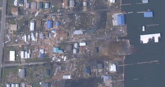
Last week we saw some of the first pictures of the damage at
Grand Isle. As the bridge to the island is still out, we are relying upon satellite images for an initial survey of the damage.
This
link and this
one will take you directly to the island. Just click on the boxes to zoom in to see the satellite images.
Here is a picture of what is left of the beach house, boat house, and marina:

Click to enlarge and to read the notes.There is damage there, but nothing compared to what we have been expecting and certainly nothing compared to the destruction of New Orleans with their double disaster. In fact, it almost looks like the beach house is still standing. Unfortunately, the same can not be said for some of the other properties on the island.
On a larger scale, this
link will show you much of the damaged Gulf coast. Again, just click the boxes to zoom in closer.
And finally, this
link will take you directly to St. Bernard Parish, where the
Canadian search and rescue team were first on the scene.


|| Permanent Link || Comments (0)